I have been working on a comprehensive communications plan with the family and one result has been the purchase of a second SPOT unit in case the first one goes belly-up. In a saltwater environment even supposedly waterproof electronic equipment can be damaged.
I catch the ferry to Port Hardy tomorrow. Final preparations only now.
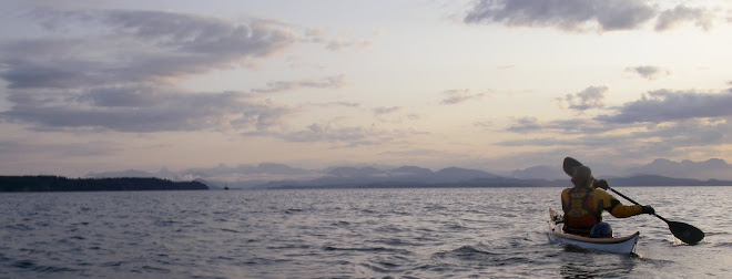
Friday, May 28, 2010
Sunday, May 23, 2010
Atlas of Canada
For the geographically challenged who do not know where Haida Gwaii is (although this may have something to do with the official name change from the Queen Charlotte Islands) you can go to online Atlas of Canada via the Links section. Click on box 103. The Atlas is actually a really good resource. You can zoom in to a scale of 1:20 000
Packing trials (the trials of solo paddling)
Yesterday was spent finalizing my food and equipment and checking that it will all fit inside my boat.
This is a frustrating stage of any expedition, where one's list of ideal kit gets hammered by the realities of kayak capacity. I had hoped to take a large tarpaulin in addition to a smaller one so that during inclement weather spent on a beach I would have a decent sheltered area but there simply is not room. The space in front of the foot pegs that usually takes the bag holding my large tarp is now occupied by the same bag stuffed with dehydrated meals. I am only certain of being able to re-supply once during the expedition (half way through, at the Village of Queen Charlotte) so I am having to take enough food for up to three weeks. The food is competing for space with water; charts, navigation equipment and tide tables; electronics, with batteries because there will not be enough sun expected to use solar power; tent, sleeping bag and sleeping pad; clothing; stove, fuel, a flat-packed back up wood stove and a small kitchen bag; a bare bones toiletries bag; medical supplies; a very few books for wildlife identification and rainy day reading; and supplies to repair stuff especially my dry suit, camping gear, water containers and boat.
Solo trips also require a paddler to take all necessary kit in the one boat (obviously). Paddling with a friend allows equipment that does not need to be duplicated to be carried by one or other, increasing the ability to take "luxuries" such as bulkier food, although the small volume British kayak (Nigel Dennis Kayaks Explorer HV) that my friends and I favour for its handling qualities and robustness has much less carrying capacity than North American style boats.
Some paddlers carry bags on either or both the front or rear deck but I have a real aversion to doing this. I already will have two parachute flares, SPOT, a GPS, my spare paddle and my chart on the front deck. This will increase the profile of the boat more than I like because it may significantly change the boat's behaviour in wind. I am also of the school that believes that the rear deck should be completely clear of any encumbrance so that re-entry in the case of capsize is not hampered.
So, pretty much everything is ready.
Monday, May 3, 2010
My equipment
I am busily preparing my kit. Much of it is the same as I took when I paddled around Vancouver Island with Doug Taylor. I am not sponsored by any manufacturers but fellow paddlers are often interested in what equipment other kayakers use.
I like to have back-up kit which is why some items (VHF radio, camera, GPS) are duplicated.
I have:
Sea Kayaking UK Explorer HV designed by Nigel Dennis
Werner Ikelos paddle
Werner Corryvrecken paddle (spare)
Kokatat MsFit PFD
Kokatat Expedition drysuit
Snap Dragon Ocean Tour EXP re-inforced spray skirt
Bare 6mm Neoprene Ice Boots
O'Neill 1.5mm DL Psycho gloves
Suunto Core wrist-top computer
SPOT satellite messenger
ACR ResQFix personal locator beacon
Uniden Voyager VHF radio
Standard Horizon HX270S VHF radio
Canon D10 waterproof camera
Pentax W30 waterproof camera
Garmin 76C mapping GPS
Garmin eTrex GPS
Subscribe to:
Posts (Atom)
.JPG)